|
Latest pictures
This picture was uploaded on
Sunday 15 February 2026 12:56:58. Reigate Parish Church...
This picture was uploaded on
Sunday 15 February 2026 12:56:58. Reigate Parish Church...
This picture was uploaded on
Sunday 15 February 2026 12:56:58. Reigate Parish Church...
This picture was uploaded on
Sunday 15 February 2026 12:56:58. Reigate Parish Church...
This picture was uploaded on
Sunday 15 February 2026 12:56:58. Reigate Parish Church...
This picture was uploaded on
Sunday 15 February 2026 12:56:58. Reigate Parish Church...
This picture was uploaded on
Sunday 15 February 2026 12:56:58. Reigate Parish Church...
This picture was uploaded on
Sunday 15 February 2026 12:56:58. Reigate Parish Church...
See all of the latest images ...
|
|
|
|
|
|
|
|
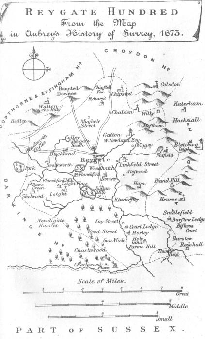
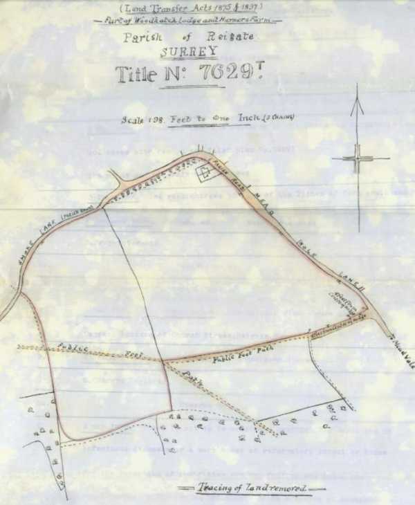
From the map in Aubrey's History of Surrey, 1673.
Taken from the Geological, Historical & Topological Description of the Borough of Reigate
and Surrounding District, by R. Phillips.

Plan of Reigate town, 1786, from "Reigate Its Story Through the Ages" by Wilfrid Cooper.
Please click on the map above for a closer look.

Publisher: Samuel Lewis.
Date: circa 1835
Furthur Information: This map is from Samuel Lewis's Topographical Dictionary,
drawn by R Creighton and engraved by J & C Walker.
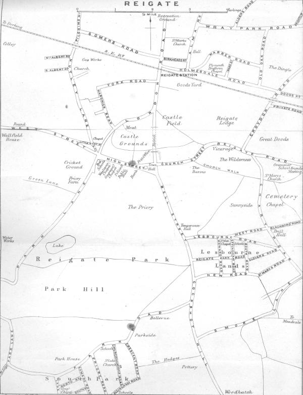
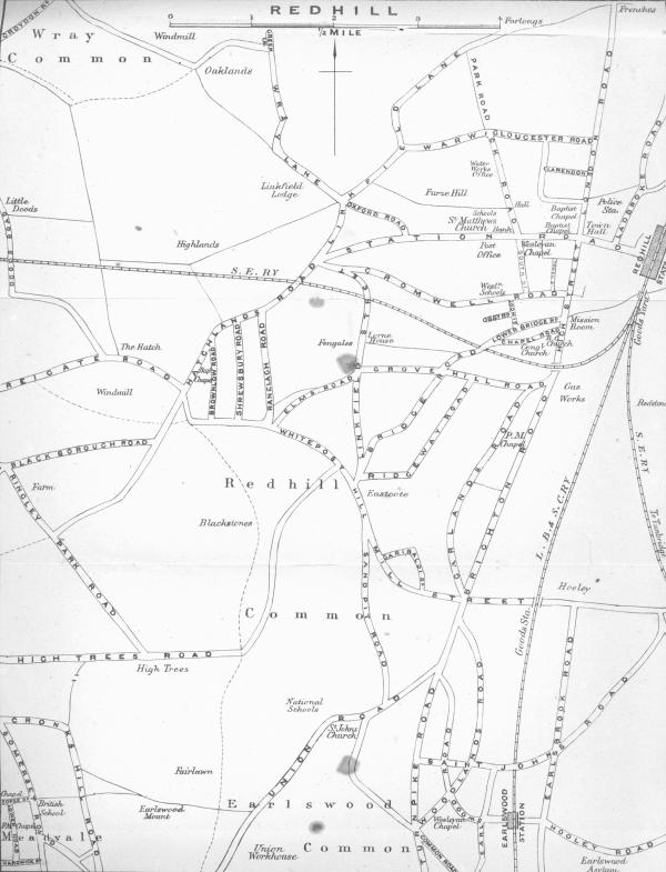
A map of Redhill, Reigate and the surrounding area from 1874.
Click on the map tiles above for a more detailed look.
Images produced from the www.old-maps.co.uk service with permission of
Landmark Information Group Ltd. and Ordnance Survey.
Copyright © and/or Database Right Landmark Information Group and Ordnance
Survey Crown Copyright and/or Database Right 2002. All rights reserved.
Taken from the Geological, Historical & Topological Description of the Borough of Reigate
and Surrounding District, by R. Phillips, 1885.
Taken from the Geological, Historical & Topological Description of the Borough of Reigate
and Surrounding District, by R. Phillips, 1885.

Map of Environs of Reigate and Redhill by Roberts & Co., circa 1900.
Please click on the map above for a closer look.

Click for a map of Gatwick. 1914. Ordnance Survey.
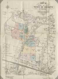
Plan of part of the Town of Reigate, 1921.
Please click on the map above for a closer look.

Surrey Sheet, 1933 with additions 1938.
Please click on the map above for a closer look.

Where the flying bombs fell in East Surrey.
The Borough In War Time. Charles W. Preston.

Plan of Reigate Parish, 1945, from "Reigate Its Story Through the Ages" by Wilfrid Cooper.
Please click on the map above for a closer look.

Map of the Borough of Reigate by G.W. May Ltd., circa 1964.
Please click on the map above for a closer look.

Map of Reigate and Redhill by Geographia Ltd. 1964.
Please click on the map above for a closer look.

Map of Reigate High Street (East), 1956.
Map of Chart Lane, turn of the century.
|
|
|
Website Copyright © 2002-2026 Paul Walters.
Ownership of all of the material on this website remains with the respective owners.
No part of the website may be reproduced or transmitted in any form or any means,
electronic or manual, without prior permission from the website author.
Please read a statement on copyright, our privacy policy, and our cookie policy.
|
|
Latest comments
Grant Mccaffetty, Merstham on
Wednesday 21 January 2026 22:49:29. How very interesting,...
Peggy McLeay, Nelson New Zealand on
Saturday 27 December 2025 03:32:03. The above mentioned...
John LESSORE, London on
Tuesday 23 December 2025 08:55:47. Robert Aaron May,
I'd...
Jill Goulder, Lewes on
Saturday 20 December 2025 19:55:23. Woodside: several people...
Janet Jones, UK on
Sunday 07 December 2025 18:41:38. I live in the small...
Howard Malleson, Horsham on
Monday 17 November 2025 18:36:39. I have come to this...
Richard Jackson, Redhill on
Sunday 16 November 2025 17:03:57. Hi Robert, Lily and Fred...
Joan Apps, Reigate on
Sunday 02 November 2025 15:22:11. Elaine Hook. You do not...
See all comments ...
|